- Popular countries
- Popular regions
- Popular cities
- Popular airports
- Car hire United Kingdom
- Car hire Italy
- Car hire Spain
- Car hire United States
- Car hire Portugal
- Car hire Greece
- Car hire France
- Car hire Poland
- Car hire Ireland
- Car hire Cyprus
- Car hire Netherlands
- Car hire South Africa
- Car hire Switzerland
- Car hire Croatia
- Car hire Canada
- Car hire Malta
- Car hire Germany
- Car hire Hungary
- Car hire Norway
- Car hire Australia
- Car hire England
- Car hire Sicily
- Car hire Scotland
- Car hire Florida
- Car hire Sardinia
- Car hire Malta
- Car hire California
- Car hire Crete
- Car hire Lanzarote
- Car hire Majorca
- Car hire Menorca
- Car hire Tenerife
- Car hire Rhodes
- Car hire Fuerteventura
- Car hire Corsica
- Car hire Kefalonia
- Car hire Madeira
- Car hire Corfu
- Car hire Ibiza
- Car hire Gran Canaria
- Car hire London
- Car hire Faro
- Car hire Malaga
- Car hire Milan
- Car hire Lisbon
- Car hire Rome
- Car hire Alicante
- Car hire Dublin
- Car hire Manchester
- Car hire Porto
- Car hire Amsterdam
- Car hire Larnaca
- Car hire Geneva
- Car hire Luqa
- Car hire Bergamo
- Car hire Athens
- Car hire Budapest
- Car hire Pisa
- Car hire Orlando
- Car hire Palermo
- Car hire London Heathrow Airport
- Car hire Faro Airport
- Car hire Lisbon Airport
- Car hire Malaga Airport
- Car hire London Gatwick Airport
- Car hire Alicante Airport
- Car hire Manchester Airport
- Car hire Dublin Airport
- Car hire Larnaca Airport
- Car hire Porto Airport
- Car hire Malta Airport
- Car hire Bergamo Airport
- Car hire Athens Airport
- Car hire Budapest Ferihegy Airport
- Car hire Rome Fiumicino Airport
- Car hire Geneva Airport (Switzerland)
- Car hire Amsterdam Schiphol Airport
- Car hire Milan Malpensa Airport
- Car hire Pisa Airport
- Car hire Orlando International Airport

The 11 Best Day Trips in the Valencian Community
Want to see the sights around Valencia? Rent a car!
Last updated: July 22, 2026.
Valencia is a wonderful city to spend a few days in. After Barcelona, it is the most important cultural center along the Spanish Mediterranean coast. The city combines an historic center with the ultra-modern and fascinating Ciutat de les Arts i les Ciències (City of Arts and Sciences). Valencia is the capital of the Comunidad Valenciana, which, in addition to the province of Valencia, consists of the provinces of Castellón (home to the Costa del Azahar) and Alicante (home to the Costa Blanca). The city serves as the gateway to the endless beaches along those coastlines, as well as to the incredibly diverse inland region.
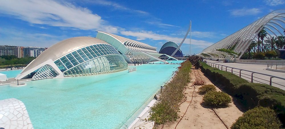
If you think the Valencia region is all about the coast, you’re wrong. You’ll find forests, lagoons, quaint towns and villages, wild, rushing rivers, waterfalls, high mountains, and vast, fertile orchards. The architecture reflects its history: from Roman ruins and Moorish fortresses to Gothic cathedrals and modernist masterpieces. Our day trips below focus mainly on inland attractions, but we also offer tips on how to drive your rental car to the best beaches and most charming coastal towns. And did you know that you’ll find the tastiest paella at a small restaurant tucked away in a village? So rent a car and hit the road!
Be well-prepared when setting out in a rental car in Spain: read up on Spanish traffic rules.
1. Montanejos
From Valencia, it takes about an hour and a half to drive to Montanejos in a rental car. That is, if you don’t stop along the way—and there are plenty of good reasons to do so. For example, take the scenic route along the CV-25 through rugged terrain, dense forests, and picturesque villages. Olocau is a beautiful mountain village surrounded by steep cliffs. Just outside the town of Navajas, a lovely hiking trail runs along the Palancia River to the Salto de la Novia, a waterfall with a story behind it. The name means “Bride’s Leap,” and according to legend, it was a tradition for a newlywed couple to cross the river. If they succeeded without touching the water, it would bring them happiness and prosperity. Unfortunately, in one instance, the bride fell into the water. The groom tried to save her, but they were both swept away by the current. The 30-meter-high waterfall is also known as the “Bridal Veil,” and when the water level is high enough, you can enjoy a lovely swim at the base. After passing the village of Xèrica, you’ll drive along yet another beautiful route through the Sierra de Espadán to Montanejos.
The healing properties of the thermal springs near Montanejos were already known to the Romans. In the thirteenth century, the Moorish king Abu Zayd had Arab-style spring baths built there. Thanks to the nutrients in the water, the women of his harem were said to “retain their youth and beauty forever.” These baths are known as Fuente de los Baños and maintain a constant temperature of 25 degrees Celsius year-round. During the summer months and Holy Week, it can get very crowded here, and you’ll also have to pay for admission. In the off-season, admission is free, and the water remains at the same pleasant temperature.
There are two other attractions near Montanejos. The first is El Chorro (The Jet), a massive stream of water shooting out from the side of a cliff. From the parking lot (actually a small side road) along the CV-20, a trail leads to a bridge over the river, where you have a perfect view of this horizontal water fountain. Not far from here lies the large reservoir, Embalse de Arenós. The same CV-20 winds past various lookout points, and you can go kayaking on the lake itself. There are many hiking trails in the Montanejos area, ranging from easy to challenging. An easy loop hike of just over four kilometers is the Sendero Familiar (Family Trail). The route begins just northwest of Montanejos and passes through the Fuente de los Baños and the Mijares River gorge to the impressive Cueva Negra (Black Cave).
There are plenty of active things to do around Montanejos: in addition to hiking and kayaking, you can go whitewater rafting, and there are also many opportunities for canyoning and rock climbing.
2. Sierra Calderona

Just north of Valencia lies the Sierra Calderona mountain range. From the northern bypass of Valencia, take the CV-315 toward Poble Nou. The first part of the route isn’t very inspiring, but once you’ve crossed the Carraixet River, you’ll already be able to see the mountains in the distance. Just before Náquerra, you’ll merge onto the CV-310, and the road climbs through pine forests and rocky terrain toward Serra. In addition to the beautiful landscape of limestone cliffs and gorges, you can enjoy spotting birds, including kestrels, goshawks, golden eagles, vultures, and buzzards. As you climb higher, the views become increasingly dramatic. On clear days, you can see the Mediterranean Sea.
Just past Serra, turn onto the CV-334 toward the Mirador del Garbí, which offers sweeping views of the surrounding mountains and valleys. On the northern side of the mountain range lies the historic town of Segorbe. The old city walls were originally built during the Moorish rule, but what you see today dates largely from the fourteenth century. Near the Torre del Botxí ( Execution Tower) is an old aqueduct that carried water from a nearby spring to the town. The Castell i Fort de l’Estrella seems a bit too well-restored—it almost looks brand-new.
3. (Ruta de) los Calderones
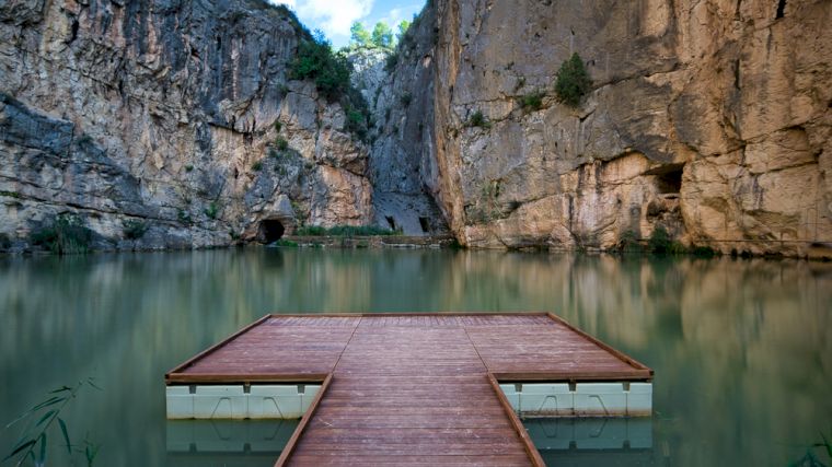
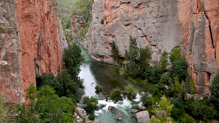
The name is very similar to that of the nature reserve we mentioned above, but Los Calderones is located in a completely different place: more than sixty kilometers northwest of Valencia. From the Valencia airport, it’s actually only a fifty-kilometer drive to the village of Chulilla, which lies next to an impressive gorge. It’s a true paradise for hikers and climbers. The five-kilometer-long Ruta de los Calderones leads deep into the gorge via two suspension bridges, following the Turia River to a beautiful reservoir. The steep limestone cliffs rise more than eighty meters high in some places. Deep within one such ravine lies the so-called Blue Pool (Charco Azul), where a wooden platform has been built and you can enjoy a refreshing swim—that is, if you’re not put off by the rather cold water.
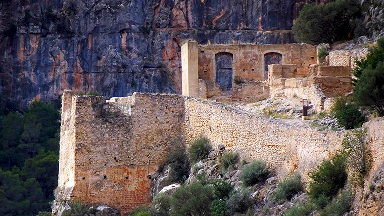
You can park your rental car at the start of the route, just north of Chulilla. In the village itself, winding alleys lead to the ruins of the Castillo de Chulilla, which towers on a rock above the village. From the top, you’ll enjoy a magnificent view of the region.
4. Castell de Xàtiva
An easy day trip from Valencia is to Xàtiva, about an hour’s drive south of the city. The main attraction is the remarkable Castell de Xàtiva (in Spanish: Castillo de Játiva). It’s best to buy your tickets online in advance. You can park your rental car right near the entrance, except on Sundays and holidays, when the castle attracts a large number of visitors. On those days, a free shuttle bus runs from Plaça Espanyoleto. Or park your car in Xàtiva anyway and follow the path up from the Ermita de Sant Feliu church through the Cova dels Coloms caves.
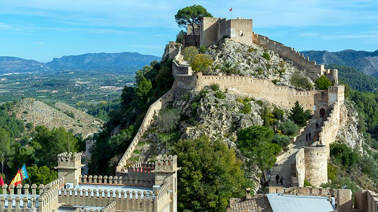
The castle marks the highest point of the defensive walls that once surrounded the entire medieval town of Xàtiva. Its unique, narrow saddle shape requires visitors to enter at the lowest point. From there, you can see the small castle (Castell Menor) winding its way upward on one side and the sprawling large castle (Castell Major) on the other. From there, you’ll enjoy a magnificent panoramic view of the Vall de Bixquert. The smaller castle was originally built during the Iberian period, before the Common Era. Later, it served as an important fortress along the Roman Via Augusta. During the Moorish period, the fortress was expanded to include the larger castle. After the Moors were driven out, the Christian kings added Gothic elements to it. The imposing architecture makes the castle a true gem, further enhanced by the fantastic views.
Don’t forget the town itself, with the Plaça del Mercat as its central gathering place—an excellent spot for a bite to eat or a drink. The Museum of Fine Arts, La Casa de l’Ensenyança, features, among other things, a portrait of King Philip V. During the War of the Spanish Succession, he ordered Xàtiva to be set on fire. In protest, the painting hangs upside down.
5. Júcar Valley
Actually, instead of driving straight back to Valencia from Xàtiva, you should take a route along the Júcar River. You’ll pass deep gorges and waterfalls, and drive through picturesque villages. On the way there, just outside Xàtiva, you can take a walk past three waterfalls or through the caves of La Cabrentà Nature Park. A little further on, there’s also a beautiful 25-meter-high waterfall, Salto de Chella. And this is just the beginning. Before you reach the Júcar, you can enjoy a refreshing dip in one of the four natural pools at Los Charcos de Quesa. The town of Cofrentes lies at the confluence of the Júcar and the Cabriel rivers. There, you can take a boat tour through the Cañones del Júcar, but there are also hiking trails along the canyon leading to an incredibly beautiful view of the river far below. Nearby, you can visit the La Cueva de Don Juan stalactite cave.
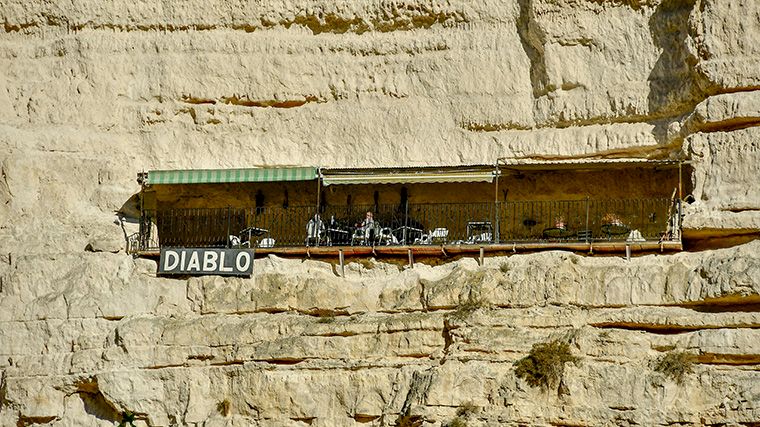
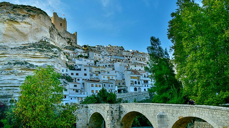
Alcalá del Júcar is situated spectacularly high above a sharp bend in the river. The village does share some similarities with Matera, the city carved out of rock in southern Italy. Along the Júcar River, too, there are many cave dwellings connected by underground tunnels. But while Matera is overrun with tourists, the fascinating landscape around Alcalá remains (for now) relatively unknown. Some of these cave dwellings are abandoned and open to visitors, but others are still inhabited to this day. In the Cuevas del Diablo, you walk through an underground network of rooms and passageways, furnished with vintage items. A long tunnel leads you to the “balcony,” a medieval lookout high up in the gorge.
The river winds like a green snake through the rocky mountains, making it an ideal spot for many adventure sports, including kayaking, rafting, rock climbing, hiking, biking, and canyoning. The Júcar offers kilometers of rocky terrain and rapids all the way to the Embalse de Alarcón reservoir, a little over an hour and a half’s drive to the northwest.
6. Maestrat: from Cervera to Morella
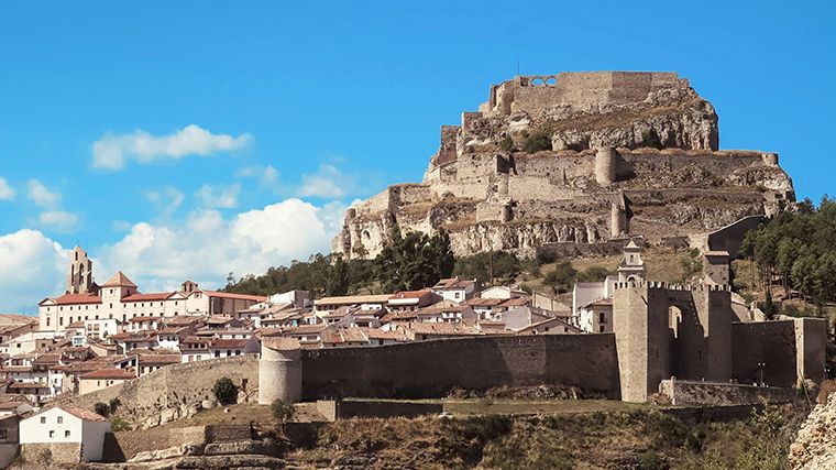
The historic region of Maestrat (in Spanish: Maestrazgo) is located in the north of the province of Castellón and is a rather remote, sparsely populated area with rugged landscapes and villages that have hardly changed since the Middle Ages. This drive offers plenty of opportunities to explore these old towns and villages and enjoy the natural beauty of the area. Before arriving in Maestrat, you’ll drive through l’Horta, the vast fertile plain surrounding Valencia, filled with orchards, rice paddies, and other farmland, crisscrossed by a network of irrigation canals that were built as far back as the Moorish era.
Cervera del Maestrat is about a two-hour drive from Valencia. This ancient village is a maze of alleys, stairways, and squares and is dominated by the ruins of a Moorish castle and the church’s bell tower in the center. Morella is just fifty kilometers away via the N-232, but be sure to take a side road every now and then and leave your rental car behind for a walk through the rugged landscape and past old churches or monasteries. For example, take a detour via the CV-111 to Vallibona, a village nestled between high cliffs.
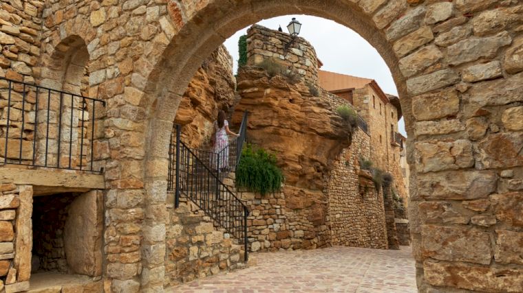
Morella is situated on a hilltop and surrounded by medieval city walls with several towers. The old town invites you to stroll through it, such as along Carrer d’En Blasco d’Alagó, one of the most charming little streets. Are you traveling with kids who’ve seen it all? Then take them to the Dinosaur Museum in Morella! It goes without saying that you’ll have a beautiful view from the castle, but if you’re in Morella in the evening, it’s worth driving just outside the town. The walls and the castle are illuminated, making for a fantastic photo.
For even more beautiful views, drive to the village of La Pobla de Benifassà in the heart of the Tinença Natural Park. Near this village, you can visit a very special sculpture garden, El Jardí de Peter, by the German artist Peter Buch. He built sculptures using stones and earth he found on site and then decorated them with discarded tiles and other scraps of debris. The colorful sculptures clearly reveal that one of his sources of inspiration is Antoni Gaudí.
7. Costa del Azahar
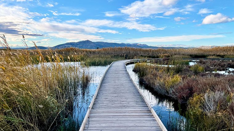
The Costa del Azahar is the coastal strip of the province of Castellón. If you drive northeast from Valencia, one of the first towns you’ll come across is Sagunto, and it’s certainly not a pretty place. So why stop there? Because the Roman and Moorish ruins on the hill are more than worth the trip. You can also enjoy a leisurely stroll through the upper part of Sagunto, the old Jewish quarter. If you’re really itching for a dip in the sea, the beach near the new part of town—Port de Sagunt—is quite nice, but there are much more beautiful beaches further along the Orange Blossom Coast.
If you turn off toward the village of La Vall d’Uixó, you can take a boat tour along an underground river in the Coves de Sant Josep (in Spanish: Cuevas de San José). Highly recommended! As you drive further north, the mountains come closer to the coast, creating rocky cliffs and secluded coves. South of Peñíscola lies the Sierra de Irta Nature Reserve. Take the exit toward Alcossebre and park your rental car at the end of Carrer del Prigó de Rei for a hike through this nature reserve or along the footpath that runs along the rocky coast near the lighthouse.
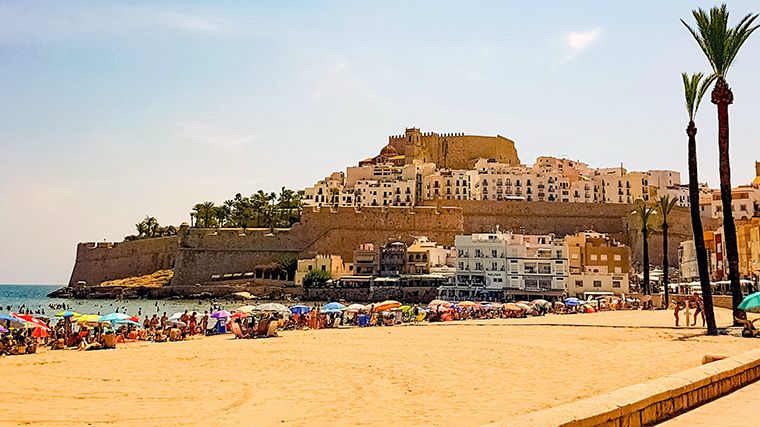
The headland on which Peñíscola is built is quite rocky. There is a large parking lot just before the old town, near Playa Sur beach. Please note: read the instructions on the parking meter carefully and select the correct rate. On Mondays, there is a market, and parking is prohibited. The old part of Peñíscola has a typical Mediterranean atmosphere and is listed among Los Pueblos más Bonitos de España. Whitewashed houses with blue ornamentation and decorated with flowers, narrow cobblestone streets, charming little squares, and even a house entirely adorned with seashells—the Casa de Las Conchas. This house is located on the route to the castle, which was built in the 14th century on the foundations of an Arab fortress. El Bufador is spectacular: when the sea is rough, water sprays high up between the houses through a hole in the rock. Peñíscola is known for its sandy beaches, which offer not only a beautiful view of the sea but also a lovely view of the old town perched high above. The two most popular are the long, narrow Playa Norte and the smaller Playa Sur.
8. l’Albufera
The vast rice paddies in the marshland just south of Valencia are also part of the l’Horta vegetable garden. These rice paddies surround Lake l’Albufera. The name derives from the Arabic al-buhayra, which means “small lake.” This wetland is a nature reserve where you can spot a wide variety of (migratory) birds. The expanses of water are dotted with traditional mud-and-reed huts called barracas.
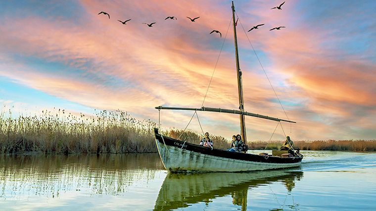
When you see those vast rice fields, you’ll understand why paella originated here. It’s no surprise, then, that the fishing village of El Palmar, right in the middle of the lagoon, is known as the place to find the best paella. Be sure to make a reservation at one of the many restaurants, because the Spaniards know where to find the best of this delicious rice dish, too. El Palmar has managed to retain the atmosphere of an authentic fishing village and serves as the departure point for beautiful boat tours through the lagoon.
Feel like relaxing on the beach for a while? Then head to the coastal strip of l’Albufera. First and foremost, you’ll find the popular Platja del Saler (Salt Beach), so named because salt was once harvested here. This beach is the closest to Valencia and is therefore busier than the beaches further south: Platja de la Devesa and Platja del Recati.
9. Costa de Valencia
Valencia has its own “Costa” with beautiful beaches and seaside towns that aren’t as crowded as those on the Costa Blanca. First among these is the small town of Xeraco (in Spanish: Jaraco), which consists of the village and the beach area, separated by the Rio Vaca and orange groves. These two locations are about four kilometers apart by car, so it’s convenient if you’ve rented a car. There are hotels and vacation apartments along the wide sandy beach, but it’s nowhere near as crowded as, say, Benidorm.
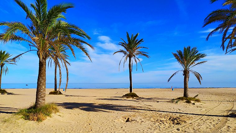
The seaside resort of Gandia, just south of Xeraco, is larger. Here, too, the town itself is separated from Gandia Beach. The beach is long and wide, with views of the mountains in the hinterland. A wide promenade runs for nearly three kilometers along the beach, starting at the marina.
A little further south lies Oliva, a town that’s just as charming as it sounds. The narrow streets in the old town exude Spanish history. For example, you can still clearly see Arab influences in the old Moorish quarter, Sant Roc, which used to lie outside the city walls. And then, of course, there are the beaches: Oliva has no fewer than ten kilometers of clean, sandy beaches that slope gently into the water, making them ideal for children. Platja Pau-Pi is the best known and busiest, while the beaches at Aigua Morta and Rabdells are a bit quieter.
10. Chera Natural Park – Sot de Chera
Water and geology take center stage in an area shaped around the valley of the Sot River, a mountainous landscape featuring gorges, ravines, natural springs, and waterfalls. The elevation ranges from 350 meters (at the Buseo reservoir) to 1,170 meters (the highest point of Cinco Picos). This area is a favorite destination for mountaineers, but “casual” hikers can also enjoy the beautiful, rugged natural scenery. Popular hiking trails of moderate difficulty lead to Pico Ropé and Morrón. If you want to better understand what you’re seeing around you, a guided hike is highly recommended. You’ll have a better chance of spotting large birds of prey and owls, or amphibians such as turtles and snakes.
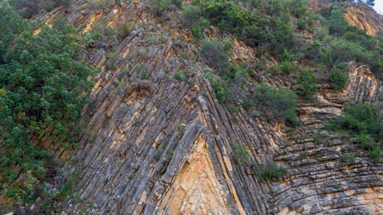
Sot de Chera is located about seventy kilometers northwest of Valencia. The CV-395 runs right through the Sot de Chera nature reserve to Chera, but of course, you should definitely leave your rental car behind to enjoy the stunning surroundings on foot. You don’t even have to get out of the car to see a unique geological formation—a so-called anticline—since it can be admired just east of Sot de Chera, and there’s even a parking lot set up there.
11. Vall d’Albaida
Roughly seventy kilometers south of Valencia lies the valley of the Albaida River. Because of its rolling hills, this region is sometimes called the “Valencian Tuscany,” though it’s much drier here than in that Italian region. Still, it’s a beautiful rural area, nestled between the Serra del Benicadell, Serra del Buixcarró, and Serra de Mariola mountain ranges. The highest point is Mount Montcabrer (1,390 m). In the Teixera d’Agres micro-reserve, you’ll find yew trees that are hundreds of years old. The valley is dotted with grapevines, orange trees, and olive groves, interspersed with historic towns.
The main roads through the Vall d’Albaida are the CV-80 and CV-62, but you’ll need to veer off these main routes to discover the most beautiful spots. For example, take your rental car to the ruins of La Carbonera Castle in the rugged cliffs near Beniatjar or the fascinating ancient paintings in the Petxina Cave in Bellús. The Ruta de los Riuraus winds past old stone cottages that were built to dry grapes and turn them into raisins. Charming villages like Bèlgida and Castelló de Rugat are great starting points for hikes through the surrounding mountains. You’ll find high-quality olive oil in Alfarrasí or Quatretonda.
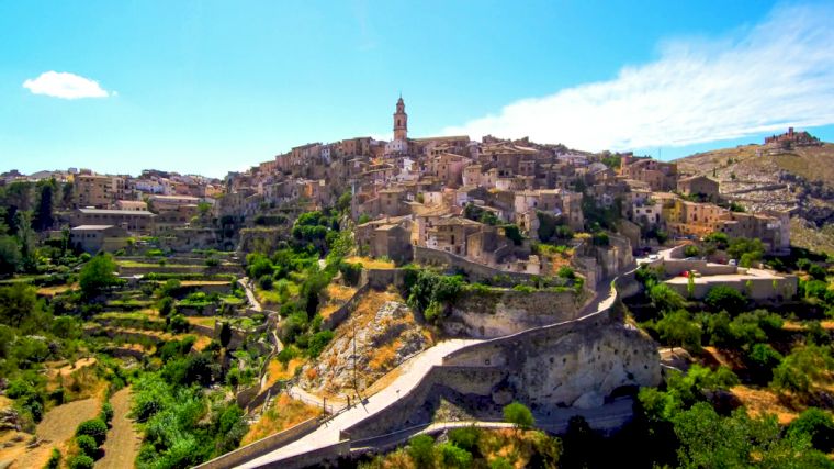
The medieval center of Bocairent is well worth a leisurely stroll. Just outside this town lie the excavated Covetes dels Moros caves, which were likely used by the Moors as (cool) storage spaces. From the outside, the rock face looks like nothing but holes, but behind them lies a veritable labyrinth of rooms and passageways. If you’re in Bocairent during the summer, take your rental car north on the CV-81 for a refreshing dip in the natural pools of Pou Clar, just before the village of Ontinyent.
Why Rent a Car in Valencia?
We hope that the tips above have convinced you that the area around Valencia is worth exploring with a rental car. The entire Community of Valencia is home to a wealth of natural attractions, which you can not only enjoy passively but also use to engage in plenty of active outdoor sports. In addition, there are interesting cultural sights, and the region is dotted with historic villages and towns. So how do you discover the best spots? By renting a car and just driving around without planning a route in advance. Feel free to use the tips we’ve provided above as a guide—you can deviate from them as much as you like. Or rather, you should deviate from them, because that’s precisely the beauty of a rental car: complete freedom and flexibility.
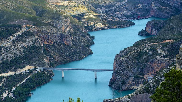
Day trips, road trip, or one-way trip?
Of course, you can combine some of the day trips listed above to create a fantastic road trip, perhaps supplemented with our tips for trips around Alicante. If you have plenty of time, you can also travel farther and rent a car for a so-called one-way rental. In that case, you’ll pick up the rental car at one location and drop it off somewhere else. Simply enter a different drop-off location, and we’ll show you only the cars for which that’s possible, including any “one-way fee.” For example, you could drive to Barcelona, Madrid, or Málaga. If you decide to do that, we have even more tips for you in our blogs “15 Trips by Rental Car Around Barcelona ” and “10 Day Trips by Rental Car from Málaga.” Or how about a fantastic road trip from Valencia to Seville to explore the wonderful region of Andalusia? The possibilities are (almost) endless. Make your dreams come true and rent a car for an unforgettable vacation in Spain!

Where would you like to rent a car?
- 24000+ pick-up locations
- Free cancellation
- Independent comparator

Useful tips for a well-prepared trip
Which insurance should I choose, and what's the deal with the deposit? Read our articles with useful information and tips to ensure you choose the right rental car for you.


- Renting a Car with Kids: The Best Routes and Stops
- La Palma by Rental Car: Routes, Day Trips, and Tips
- Explore 18 top destinations around Girona in a rental car
- The Best Road Trips Around Madrid in a Rental Car
- 15 Tips for the Best Vacation in Menorca
- Exploring the Fantastic Basque Country in a Rental Car