- Popular countries
- Popular regions
- Popular cities
- Popular airports
- Car hire United Kingdom
- Car hire Italy
- Car hire Spain
- Car hire United States
- Car hire Portugal
- Car hire Greece
- Car hire France
- Car hire Poland
- Car hire Ireland
- Car hire Cyprus
- Car hire Netherlands
- Car hire South Africa
- Car hire Switzerland
- Car hire Croatia
- Car hire Canada
- Car hire Malta
- Car hire Germany
- Car hire Hungary
- Car hire Norway
- Car hire Australia
- Car hire England
- Car hire Sicily
- Car hire Scotland
- Car hire Florida
- Car hire Sardinia
- Car hire Malta
- Car hire California
- Car hire Crete
- Car hire Lanzarote
- Car hire Majorca
- Car hire Menorca
- Car hire Tenerife
- Car hire Rhodes
- Car hire Fuerteventura
- Car hire Corsica
- Car hire Kefalonia
- Car hire Madeira
- Car hire Corfu
- Car hire Ibiza
- Car hire Gran Canaria
- Car hire London
- Car hire Faro
- Car hire Malaga
- Car hire Milan
- Car hire Lisbon
- Car hire Rome
- Car hire Alicante
- Car hire Dublin
- Car hire Manchester
- Car hire Porto
- Car hire Amsterdam
- Car hire Larnaca
- Car hire Geneva
- Car hire Luqa
- Car hire Bergamo
- Car hire Athens
- Car hire Budapest
- Car hire Pisa
- Car hire Orlando
- Car hire Palermo
- Car hire London Heathrow Airport
- Car hire Faro Airport
- Car hire Lisbon Airport
- Car hire Malaga Airport
- Car hire London Gatwick Airport
- Car hire Alicante Airport
- Car hire Manchester Airport
- Car hire Dublin Airport
- Car hire Larnaca Airport
- Car hire Porto Airport
- Car hire Malta Airport
- Car hire Bergamo Airport
- Car hire Athens Airport
- Car hire Budapest Ferihegy Airport
- Car hire Rome Fiumicino Airport
- Car hire Geneva Airport (Switzerland)
- Car hire Amsterdam Schiphol Airport
- Car hire Milan Malpensa Airport
- Car hire Pisa Airport
- Car hire Orlando International Airport

12+ Must-See Attractions Around Las Vegas
The perfect starting point for road trips in a rental car
The most famous nickname for Las Vegas is Sin City, but there are many others, including the Entertainment Capital of the World. In addition to gambling in the casinos, you can enjoy outstanding theater shows and performances by top artists. For an adrenaline rush, hop on a roller coaster that suspends you 275 meters above the ground (The Ride) or let yourself fall from that height (SkyJump). But Las Vegas is much more than casinos, clubs, and dazzling lights: it’s the gateway to some of the most breathtaking natural wonders in the southwestern United States.
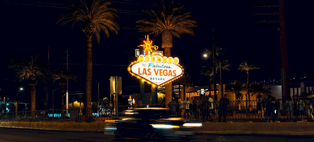
The city is a perfect starting point for an amazing road trip. Several iconic national parks and nature reserves are easily accessible from Las Vegas by rental car. You can often enjoy outdoor activities in this impressive natural setting: hiking, rock climbing, mountain biking, rafting, and kayaking. Below, we describe trips to some of the most beautiful attractions around Las Vegas. Of course, you can also combine these different destinations into one long road trip through Nevada and neighboring states.
1. Red Rock Canyon / Mt. Charleston Scenic Byway
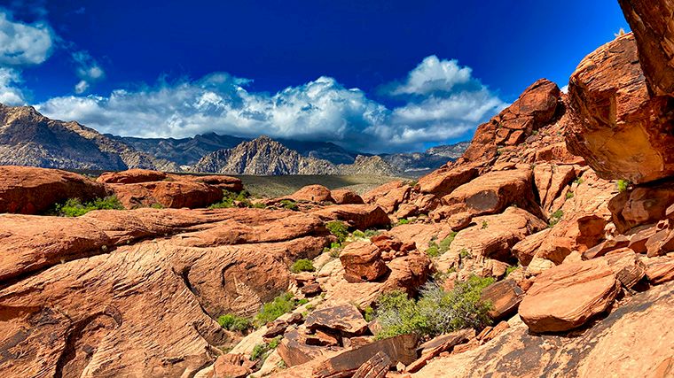
Want to get used to the car you just rented at the Las Vegas airport or in the city itself? Then take a short and easy day trip to Red Rock Canyon.
This protected nature reserve features a stunning landscape of mountain peaks, bright red rock hills, sandstone ridges, steep canyons, and ancient rock art. The best way to see the most beautiful spots is to drive along Scenic Drive, a route spanning over 20 kilometers. If you don’t stop anywhere, you can drive that route in 45 minutes, but you’ll miss a lot. You can easily spend the whole day here and still not see everything. Take your time to enjoy the breathtaking views, unique rock formations, and the beauty of the desert landscape.
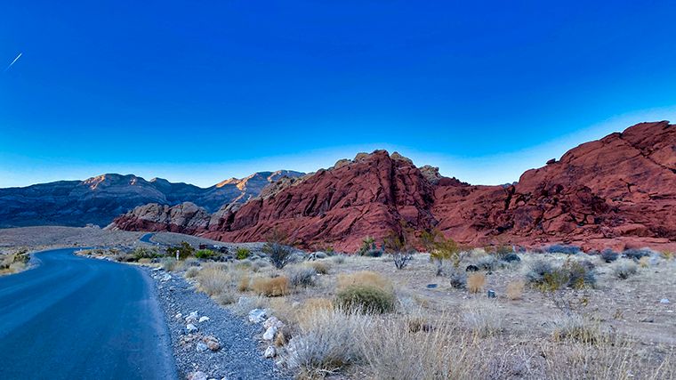
There are several hiking trails, and they’re clearly marked with colors to indicate whether they’re easy (green), moderate (orange), or challenging (red). Don’t miss the mostbeautiful overlooks along the way: Sandstone Quarry, High Point, and Red Rock Wash. Easy hiking trails followboardwalks, such as the Red Spring Boardwalk at the base of the Calico Hills. These hills are a paradise for rock climbers. Most hiking trails have picnic areas where you can enjoy your lunch with a fantastic view.
Plan your trip carefully and decide where you want to stop. You won’t be able to drive back, as the route is one-way. Please note: From October 1 through May 31, you must reserve a time slot to access the Scenic Drive. Alternatively, if you start this drive before 8 a.m., you won’t need a reservation.
Can’t get enough of scenic routes? Then take the Mt. Charleston Scenic Byway, a delightful road that winds around Mount Charleston. In the summer, this drive offers a cool respite from the hot temperatures in Las Vegas. Plus, you’ll see plenty of wildflowers during this time of year. At the Desert View Overlook, you can see for miles if you walk from the parking lot to the observation decks. A little further on is the start of several hiking trails, including the Sawmill Trail, an easy four-kilometer hike. You can reach this beautiful road by turning off US-95 toward Kyle Canyon. The signs there also say “ski resort.” Huh, skiing in the desert? That’s right—in winter, there’s snow on the peaks of the Spring Mountains.
2. Death Valley
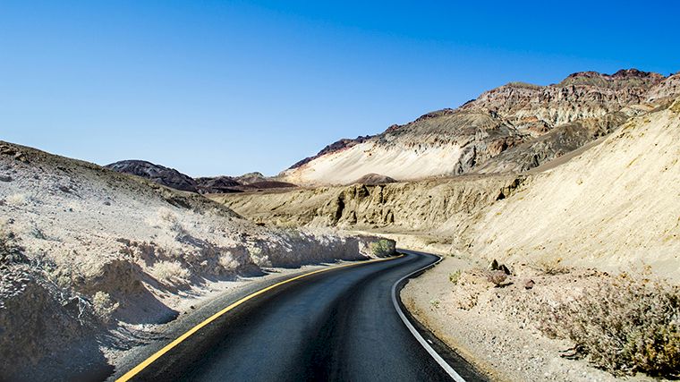
Further west, you'll arrive in Death Valley, which, despite its terrifying name, offers an amazing experience. Don’t take the fastest route there (via US-95), because it’s deadly boring. Take a little more time and, from Las Vegas, take State Route 60 to Pahrump. In that town, don’t go straight through; instead, turn left and take SR-372 to cross the border into California. On the California side, this road is numbered CA-178. Near the town of Shoshone, signs point to Death Valley, and you’ll take CA-127 over Deadman Pass in the Sierra Nevada to Death Valley Junction. There, turn left and continue on CA-190 for nearly fifty kilometers to Furnace Creek, on the eastern side of the national park.
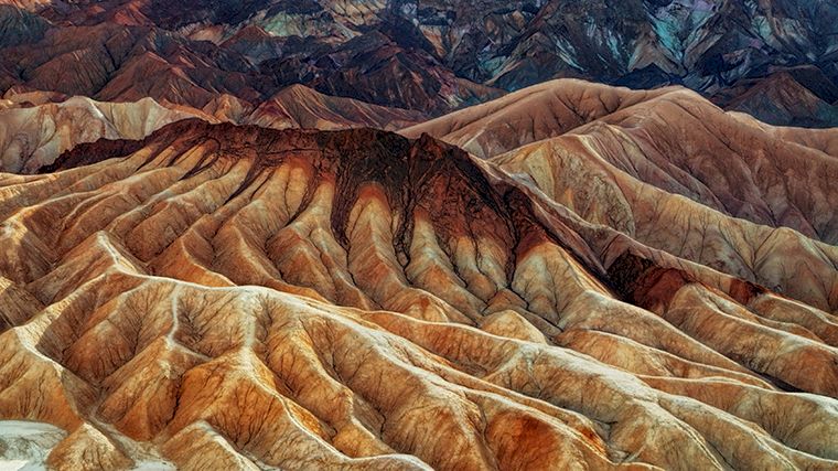
It’s an incredibly beautiful area where you can spend several days if you really want to see everything. Death Valley is home to the hottest, driest, and lowest point in the United States. The Badwater Basin salt flat lies more than 85 meters below sea level, and the persistent drought and record-breaking heat in the summer make Death Valley a land of extremes. In early spring, it’s an overwhelming experience to see snow on the highest peaks and, with a little luck, the valley covered in a vast carpet of wildflowers. This so-called “superbloom” appears after rainfall, which is quite rare. But even without this floral splendor, the wilderness of Death Valley is a must-see: salt flats, rock formations, canyons, sand dunes, mountains, and the pastel-colored, undulating landscape at Zabriskie Point. You’ll find whimsical rock formations along Artists Drive, which has a turnoff to Artists Palette, where the rocks display truly unique colors.
3. Hoover Dam / Lake Mead
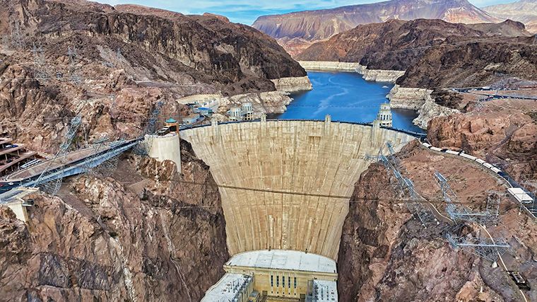
In a rental car, it takes about half an hour to drive from Las Vegas to Boulder City. Just over twelve kilometers northeast of this city lies the Hoover Dam, which was built in the 1930s. It was a marvel of modern engineering for its time. If you want to see the dam up close, make sure you take the right road. You’ll need to get onto the Hoover Dam Access Road, which is marked by brown road signs. If you continue straight on the highway, you’ll pass by the dam, but you won’t see much of it.
Hoover Dam is located on the Colorado River, which forms the border between Nevada and Arizona at this point. Before you reach the dam itself, you can park in the lot for the “scenic view.” From that parking lot, a zigzagging path leads to the walking trail along US-93 (also Interstate 11). This is where you’ll find the best view, and you’ll see the dam as shown in the photo above.
You can drive your rental car across the dam, and there are parking spots on both sides, but of course, you’re not allowed to stop on the dam itself. So walk across it to get a sense of its enormous height and to enjoy a beautiful view of the imposing Colorado Bridge.
The historic Railroad Trail begins at the Lake Mead Visitor Center; trains once ran along this trail to transport construction materials to the dam. The trail passes through tunnels that were drilled for that purpose and runs along Lake Mead. Avoid taking this hike during the hot summer months, as there is no shade at all—except inside those tunnels. You can cool off in the waters of Lake Mead at Boulder Beach, five kilometers north of the visitor center.
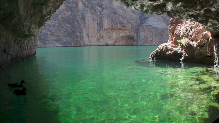
Past the dam, it’s a twenty-kilometer drive to Willow Beach Scenic Overlook, where you’ll have a spectacular view of the black lava rocks of Black Canyon. In Willow Beach, you can rent a kayak to paddle out to the emerald-green waters of Emerald Cave. It’s almost impossible to imagine that you’re right in the middle of the desert there. Keep an eye out for bighorn sheep, falcons, and bald eagles along the way.
4. Route 66 / Grand Canyon
The Grand Canyon was formed by the Colorado River and its tributaries. If you’re starting in Las Vegas, it’s quite a drive to Grand Canyon Village (450 kilometers), so it’s best to break the route up into segments. After Boulder City, Kingman is a good place to stop. This town lies along the famous Route 66 and even has a museum dedicated to it, full of interesting facts and history. The exhibition of historic electric vehicles is particularly fun. Did you think electric cars were a new invention? Not at all—go check it out in Kingman.
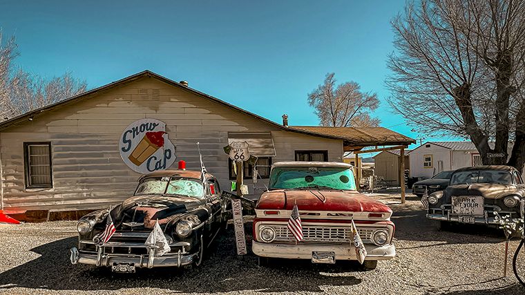
The next stop, Seligman, is just an hour’s drive away on I-40. But who wouldn’t want to drive at least a short stretch of the famous Route 66, once the main link between Chicago and Los Angeles? You can do that, though it will take a little longer—not only because the route is 15 miles (24 kilometers) longer, but also because you’re bound to stop a few times along the way. For example, at the Hackberry General Store or the Burma Shave Signs. In downtown Seligman, you’ll find countless classic cars and vintage motorcycles, historic gas stations, 1950s-style diners, and murals that bring the myth of that era to life.
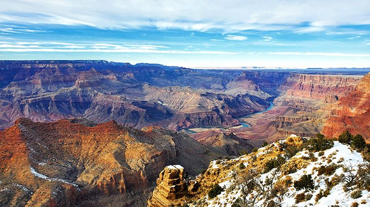
From Seligman, it’s nearly 160 kilometers by car to Grand Canyon Village on the South Rim. The visitor center there is the best place to figure out exactly where you want to go in this vast area. Are you in pretty good shape and not afraid of some climbing and scrambling? Then take the Bright Angel Trail to the bottom of the canyon. This isn’t for everyone, though, because the hike is 9 miles (15 kilometers) long, and you’ll have to make your way back up as well. Moreover, it’s much warmer (not to say hot) down in the canyon than at the top. An easier option is to cover (part of) the route by mule.
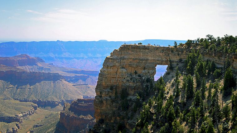
Desert View Drive on the south side of the Grand Canyon offers spectacular views, but it’s a heavily visited part of the national park. The North Rim attracts far fewer people, and the views there are phenomenal as well. Moreover, the north rim is at a higher elevation and is therefore cooler. To reach that side of the canyon, drive from Las Vegas via I-15 to St. George, then continue via Fredonia to the North Rim. Note that this route isn’t possible in winter, as the final section (State Route 67) is closed then. You can check the Grand Canyon’s website to see which roads (and hiking trails) are closed. On the route to the North Rim, you’ll pass Zion National Park, among other places. Or you can drive east of the canyon via Page to the North Rim. That route takes you past Antelope Canyon and the famous Horseshoe Bend.
Grand Canyon West is very popular, especially because of the Skywalk, high above the canyon. It’s much closer to Las Vegas (over 200 kilometers), but the reviews aren’t exactly positive. For one thing, you often have to wait a long time for the shuttle buses that run between the parking lot and the entrance to the observation deck. Then you have to wait there as well, and to make matters worse, you’re not allowed to take your own photos unless you pay a hundred dollars… And if you decide to visit the Skywalk: the glass panels are so scratched up that they can barely be called transparent anymore.
5. Water Activities / Havasu Falls
After all those beautiful—but dry—rocks, are you ready for a little water? Keep in mind that rivers like the Colorado River flow through this dry desert, and thanks to the dams, there are also large lakes. In various places, you can swim, go rafting, kayaking, rowing, wakeboarding, water skiing, or tubing. Or you can rent a small boat to go out on your own.
We already mentioned Lake Mead and Willow Beach near Boulder above. The latter is quite rocky, and many people don’t go in the water to swim there, but instead enjoy a barbecue by the water’s edge. A little further away, you’ll find the recreation area Big Bend, just south of Laughlin. It has a beautiful, large beach with water that stays nice and cool even on the hottest days. Even further south, you’ll reach the Havasu National Wildlife Refuge, nestled among high cliffs, where you can swim, fish, and go boating, and where you can also go birdwatching.
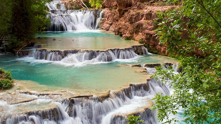
Don’t confuse this with Havasu Falls, because those are located somewhere else entirely. Those are fantastic waterfalls, by the way, but it’s a rather exclusive experience. It costs a pretty penny to stay overnight at the lodge or campground in the Havasupai Reservation, and you’ll need to be prepared for a challenging hike. You’ll also need a permit, which you can apply for through the official website. If you’re one of the lucky few who manage to secure a permit, you’re in for an experience you’ll never forget. Tucked away among the rocks, Supai is a stunning oasis with five blue-green waterfalls.
6. Zion National Park
If you’re driving to the North Rim of the Grand Canyon, Zion National Park is a welcome stop along the way. It’s an almost unimaginably green area in an otherwise arid landscape. From Las Vegas, it’s about a 250-kilometer drive in a rental car. Along the way, you’ll drive through the magnificent Virgin River Gorge, which closely resembles the Grand Canyon, and past the red cliffs and dunes near St. George. It’s a great idea to stop here for a bit and rent an off-road motorcycle to explore this rugged terrain.
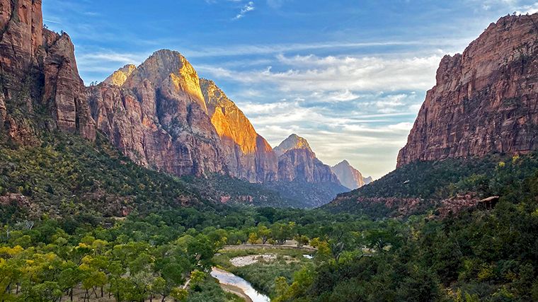
The Virgin River nourishes the lush green vegetation between the nearly vertical rock walls on either side in Zion National Park. Part of the park, Zion Canyon, is accessible only by shuttle bus from March through November (except during Christmas week), as the road to the most popular hiking trails—such as Angels Landing and The Narrows, where you have to wade through the river at the narrowest part of the canyon—would otherwise become far too crowded. Easier hikes include the Emerald Pools Trail and the Canyon Overlook Trail. During the off-season, you can drive to the most popular trailheads yourself, and there’s a good chance you’ll see snow on the peaks of the red rocks—an enchanting sight.
Outside Zion Canyon, during peak season you can drive your rental car on any other road in the park, such as State Route 9, which runs eastward from the western entrance at Springdale. It’s a stunningly beautiful road that follows the course of the Virgin River. To avoid the crowds, head to the Kolob Canyons, tucked away in the northwestern corner of the park. The road cuts across a mountain ridge and climbs 300 meters to Kolob View Point. From there, you can walk a short distance further to the Timber Creek Overlook.
7. Bryce Canyon / Scenic Byway 12
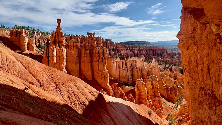
If you drive east on State Route 9, you'll arrive in Mount Carmel. From there, it's a little over an hour's drive to Bryce Canyon City, the gateway to Bryce National Park. The main attraction here is the so-called hoodoos—vertical rock pillars formed by the combined forces of freezing and thawing. The sun casts shades of pink, orange, and red. The Bryce Canyon Scenic Drive is a 19-mile (30-kilometer) route that extends beyond the most famous viewpoint, the Amphitheater. Some of the best other viewpoints include Rainbow Point, Yovimpa Point, Ponderosa Canyon, and Natural Bridge. But be sure to leave your rental car behind every now and then and stretch your legs! The easiest hike is the Queens Garden Trail. Slightly more challenging is the Navajo Trail, a path surrounded by Douglas firs that leads to the bottom of the canyon.
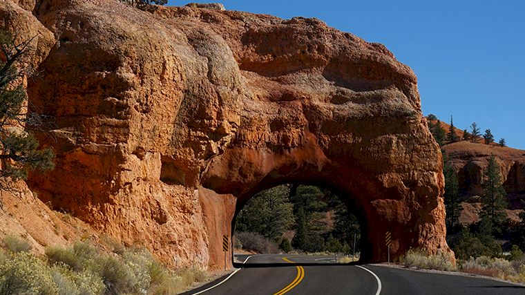
State Route 12 runs through the picturesque northeastern part of Bryce Canyon. Even if you follow this route, you’ll want to pull over every now and then, for example at the Mossy Cave parking lot, a overhanging rock with an underground spring. In the summer, the cave is cool, with water dripping from hanging gardens. In winter, the cave is filled with gigantic icicles. There’s also a beautiful waterfall. Just past Henrieville, you’ll drive past the rock formations known as the Grand Staircase.
8. Antelope Pass / Horseshoe Bend
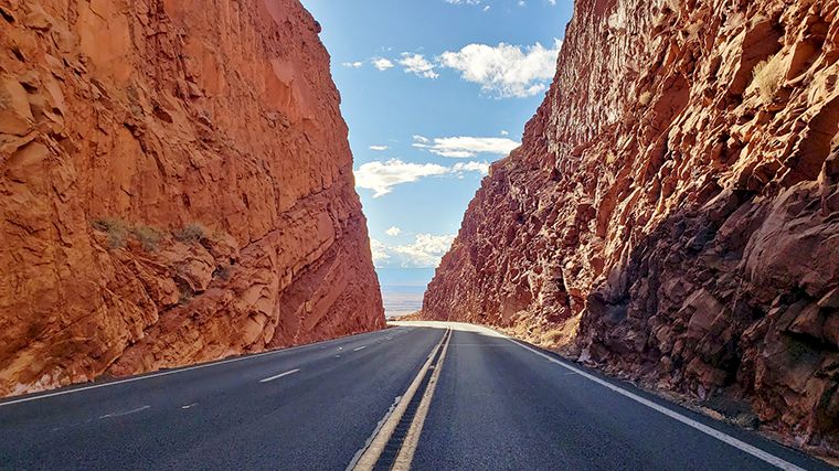
If you’re driving along Highway 89 toward Page on the east side of the Grand Canyon, you’ll cross Antelope Pass just past the junction with Highway 89A. From Bitter Springs, it’s a fairly steep climb along the edge of a cliff. So keep in mind that large trucks drive up very slowly. At the top, you’ll drive between towering rock walls on both sides of the road. It’s also worth taking Highway 89A in Bitter Springs to see the two bridges over the Colorado River: the oldest is for pedestrians and the other is for cars. There’s a parking lot just before the bridges, and from the pedestrian bridge you can see the river far below—and if you’re lucky, you might even spot birds of prey, such as the impressive American condor.
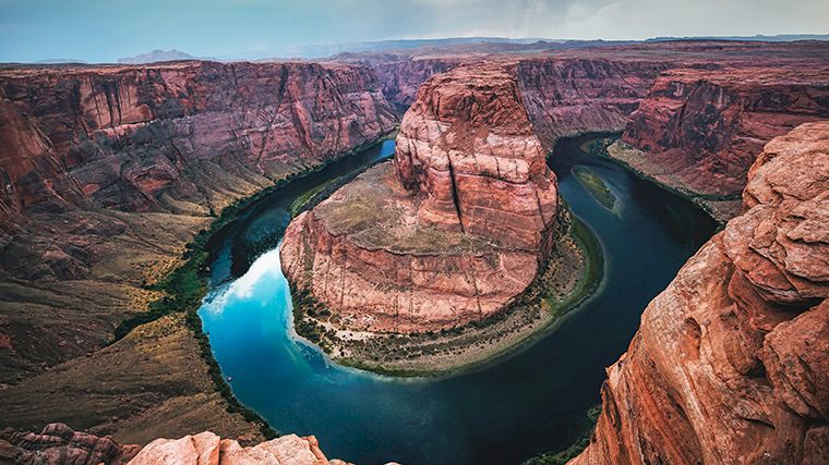
Along Highway 89, there are several lookouts with breathtaking views. Among other sights, you’ll pass the famous Horseshoe Bend, where the meandering Colorado River makes a sharp turn around the rocks. About eight kilometers before Page, there’s a turnoff to a spacious parking lot. From there, a paved trail leads to the observation deck. The trail is nearly one kilometer long and offers little shade (there are two shaded spots along the way), so wear a hat and bring water. Once you reach the overlook, you’ll be left speechless. No matter how many times you’ve seen this in photos, it’s many times more impressive in person: the nearly circular bend and the deep canyon that the river carved out millions of years ago.
Page is located near the Glen Canyon Dam, which is virtually identical to the Hoover Dam, though slightly lower (just five meters) and nearly one hundred meters wider. The dam created Lake Powell, a wonderful lake for various water activities. From the dam, you can kayak down the Colorado River.
9. Antelope Canyon
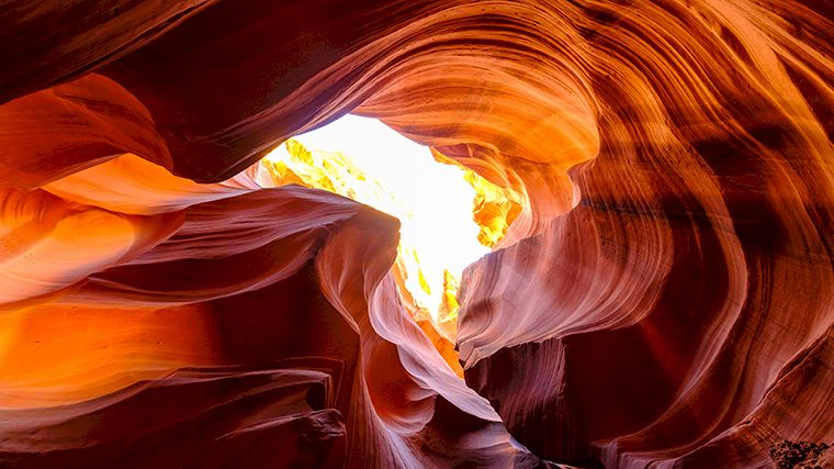
Antelope Canyon is a slot canyon with narrow, eroded passages and undulating rock formations. You can only visit this canyon on a guided tour, and the tours are very popular. Tickets often sell out well in advance during the peak months of May through September. So be sure to book well in advance online with one of the official tour operators. You’ll need to choose between Upper and Lower Antelope Canyon. The latter is slightly less crowded, but very narrow in some places. There are also quite a few stairs to reach the different sections. The tour is slightly cheaper than the one through Upper Antelope Canyon, which offers easier access and is famous for the beams of light that make for stunning photos. Incidentally, these beams are only visible at certain times of the day between April and October. Another difference between the two canyons is that the tour through Lower Antelope Canyon is one-way, whereas in the other canyon you’ll encounter oncoming visitors. Whichever of the two you choose, down in the canyon you’ll be surrounded by colorful Navajo sandstone rocks that twist and turn into unique patterns and spirals. Walking among these towering, dramatic rock formations, it feels as if you’re in another world.
10. Monument Valley
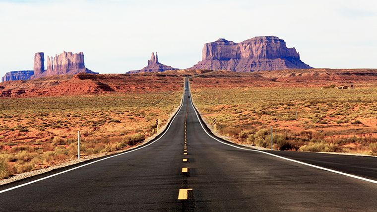
Since you're in Page anyway, you might as well take a quick trip to Monument Valley , which is a little over two hours’ drive to the east, on the border between Arizona and Utah. When you see those rocks looming at the end of a dead-straight road, you might think, “I’ve seen this somewhere before, haven’t I?” You might be right, because this landscape has served as the backdrop for scenes in countless movies and commercials. Some of these enormous red rocks are over a hundred meters high and are kilometers apart, even though it doesn’t seem that way from a distance. Enjoy the view, but don’t drive through the valley yourself in your rental car, because you’ll inevitably get stuck in the sand.
11. Techatticup Gold Mine / Nelson Ghost Town
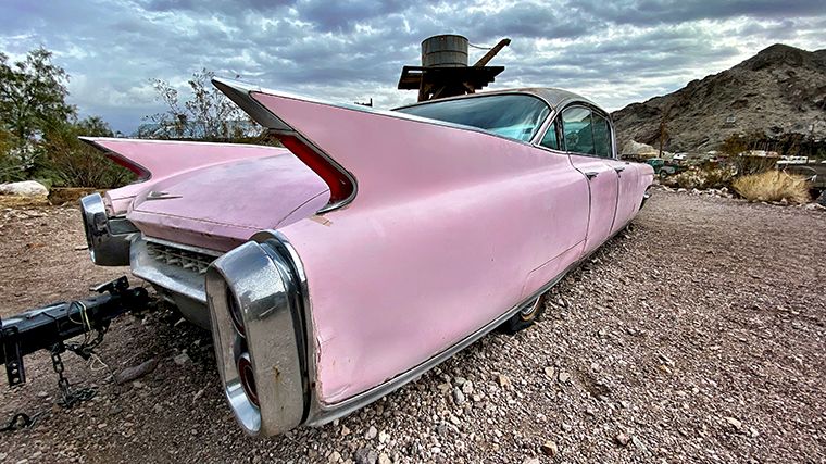
The small town of Nelson is located seventy kilometers southeast of Las Vegas and began as Eldorado, so named by the Spaniards because of the gold discoveries there. That discovery sparked a gold rush, and the gold prospectors often came into conflict with one another. In the nineteenth century, shootouts and murders were commonplace. It’s hard to imagine that today’s somewhat sleepy Nelson was once a truly rough-and-tumble Wild West town. The area around the former Techatticup gold mine, however, is very reminiscent of the Wild West. The rusty old cars and gas pumps in Nelson Ghost Town are from a later period. The main attraction is the mine itself. Be prepared for a significant difference in temperature. While it can reach nearly 40 degrees Celsius outside in the summer, the temperature inside the mine remains a constant, cool 18 degrees. You’ll learn about gold mining and the gold rush in this area, and there’s plenty of old mining equipment on display. The enormously deep borehole is spectacular. You must make a reservation for the gold mine tour, and the tour will only take place if at least four adults have signed up.
12. Valley of Fire
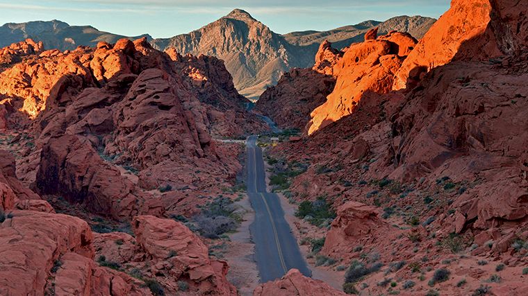
Don’t feel like driving far? Then head to the Valley of Fire, just a 50-mile (over 80-kilometer) drive from downtown Las Vegas. In addition to the landscape of bright red Aztec sandstone cliffs nestled among gray and brown limestone, this park features ancient petrified trees and petroglyphs that are more than two thousand years old. You can park your rental car at the visitor center, which is a great starting point to learn more about the landscape and its former inhabitants.
Especially in the late afternoon sun, these deep-red rocks seem to be on fire. Mouse’s Tank Road is the unofficial name for White Domes Road, which runs from the visitor center to the end of the park. Many of the more than ten hiking trails start along this main road, including the Fire Wave Trail. You definitely shouldn’t miss this one, because the rocks are incredible, with bands of red, light pink, orange, and cream swirling around each other. As you drive along the main road, you’ll remember why you rented a car: to the left and right of the winding road stand magnificent, towering red rocks.
Please note: because temperatures rise very high during the summer months, many hiking trails in the park are closed from mid-May through the end of September. The Valley of Fire website lists the current closure dates.
Renting a car or RV in Las Vegas?
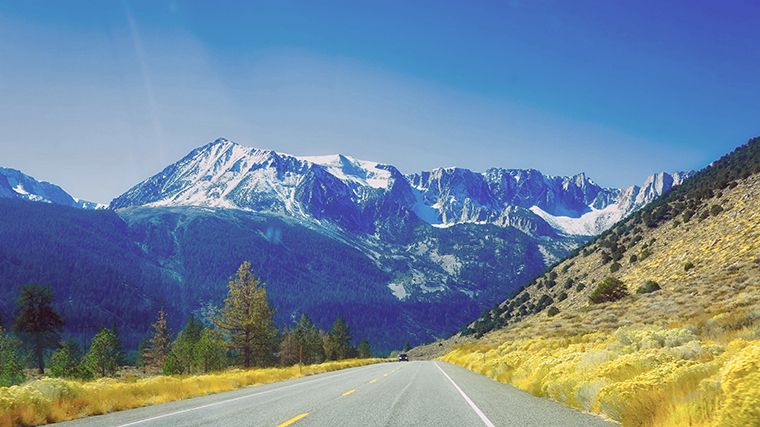
If you’re planning to set out from Las Vegas in a rental car, you’ll face several choices. Will you choose a passenger car, or will you rent an RV? With the latter option, you won’t have to look for hotels, and there are many places in the U.S. where you can spend the night in an RV (Recreational Vehicle).
Another question is: will you return the rental car to Las Vegas, or will you opt for a one-way rental, where you drop off the car at a different location than where you picked it up? Many of the national parks we described above are quite a distance from Las Vegas. In that case, it’s nicer to continue on to another final destination, such as Denver. You can then visit even more parks, like Mesa Verde or Arches National Park. Other popular one-way destinations from Las Vegas include Salt Lake City, Albuquerque, and Los Angeles.

Where would you like to rent a car?
- 24000+ pick-up locations
- Free cancellation
- Independent comparator

Useful tips for a well-prepared trip
Which insurance should I choose, and what's the deal with the deposit? Read our articles with useful information and tips to ensure you choose the right rental car for you.


