- Popular countries
- Popular regions
- Popular cities
- Popular airports
- Car hire United Kingdom
- Car hire Italy
- Car hire Spain
- Car hire United States
- Car hire Portugal
- Car hire Greece
- Car hire France
- Car hire Poland
- Car hire Ireland
- Car hire Cyprus
- Car hire Netherlands
- Car hire South Africa
- Car hire Switzerland
- Car hire Croatia
- Car hire Canada
- Car hire Malta
- Car hire Germany
- Car hire Hungary
- Car hire Norway
- Car hire Australia
- Car hire England
- Car hire Sicily
- Car hire Scotland
- Car hire Florida
- Car hire Sardinia
- Car hire Malta
- Car hire California
- Car hire Crete
- Car hire Lanzarote
- Car hire Majorca
- Car hire Menorca
- Car hire Tenerife
- Car hire Rhodes
- Car hire Fuerteventura
- Car hire Corsica
- Car hire Kefalonia
- Car hire Madeira
- Car hire Corfu
- Car hire Ibiza
- Car hire Gran Canaria
- Car hire London
- Car hire Faro
- Car hire Malaga
- Car hire Milan
- Car hire Lisbon
- Car hire Rome
- Car hire Alicante
- Car hire Dublin
- Car hire Manchester
- Car hire Porto
- Car hire Amsterdam
- Car hire Larnaca
- Car hire Geneva
- Car hire Luqa
- Car hire Bergamo
- Car hire Athens
- Car hire Budapest
- Car hire Pisa
- Car hire Orlando
- Car hire Palermo
- Car hire London Heathrow Airport
- Car hire Faro Airport
- Car hire Lisbon Airport
- Car hire Malaga Airport
- Car hire London Gatwick Airport
- Car hire Alicante Airport
- Car hire Manchester Airport
- Car hire Dublin Airport
- Car hire Larnaca Airport
- Car hire Porto Airport
- Car hire Malta Airport
- Car hire Bergamo Airport
- Car hire Athens Airport
- Car hire Budapest Ferihegy Airport
- Car hire Rome Fiumicino Airport
- Car hire Geneva Airport (Switzerland)
- Car hire Amsterdam Schiphol Airport
- Car hire Milan Malpensa Airport
- Car hire Pisa Airport
- Car hire Orlando International Airport

Driving Through the Canadian Rockies in a Rental Car
Rent a car and explore more than just the Icefields Parkway
Calgary is the largest city in the Canadian province of Alberta and a gateway to the Rocky Mountains. For most visitors, those mountains are the main reason to fly into Calgary Airport: in the winter because of the amazing ski resorts, and in the summer for the fantastic road trips you can take there, such as along the Icefields Parkway. That’s the most famous route, and we can’t help but describe it, but there are other beautiful roads and attractions you can visit if you rent a car in Calgary. Below, we describe the best sights in western Canada.
We can’t possibly describe all the beautiful trails and nature parks here. We recommend downloading the Parks Canada app (Android / Apple), as it contains an incredible amount of information. For various routes, interesting stops are accompanied by anecdotes or fun facts. Very handy! Be sure to download this app before you start driving or hiking through a national park, because cell phones often have no service in many nature areas.
Calgary
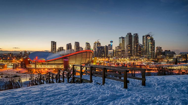
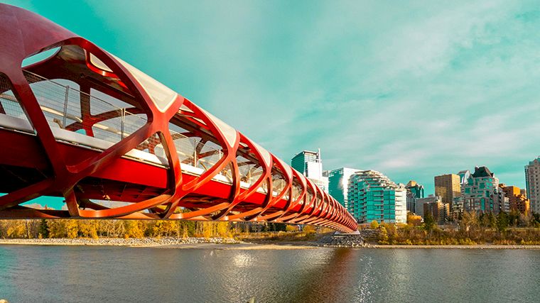
Calgary isn’t just a gateway city—it has plenty to offer in its own right. It’s a very modern city with hardly any historic buildings, but it does feature some beautiful examples of modern architecture. To name a few: the Central Library (be sure to check out the interior as well), the Telus Sky office tower, which is intriguingly lit up at night, the Peace Bridge designed by Santiago Calatrava, and the city’s tallest building, The Bow. When it opened in 1968, the Calgary Tower was the tallest structure. The exterior of Studio Bell is controversial, but inside you’ll find an interesting museum entirely dedicated to music. The National Music Centre offers an interactive experience of sounds and musical instruments.
You can experience what life was like in days gone by at Heritage Park, where a pioneer town has been recreated, you can view antique cars (and gas pumps), and take a ride on an old steam train or the historic paddlewheel steamboat.
When the weather is warm, tubing or rafting on the Bow River is a great way to spend half a day. Would you rather go biking? There are bike paths on both banks of the river, between the Montgomery and Inglewood neighborhoods.
Inglewood Bird Sanctuary is a serene park on the east side of the city. It’s home to countless bird species, and you can spot several of them if you take the time to sit quietly on one of the strategically placed benches. The best time to visit is in the fall, when the park is ablaze with vibrant autumn colors.
The view of downtown Calgary from Nose Hill is spectacular. Park your rental car in one of the parking lots along 14th Street NW or John Laurie Blvd NW and walk a short distance uphill.
Banff / Minnewanka Scenic Loop
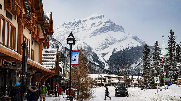
Banff is a mountain town with charming cafes and restaurants, but it does get very crowded during the summer months. If you drive there from Calgary in your rental car, you’ll first pass through Canmore, which is quieter. That’s also the starting point of the Grassi Lakes Trail, a hike along the lakes on the west side of town. Also beautiful is Lake Minnewanka, nestled in the mountains east of Banff.
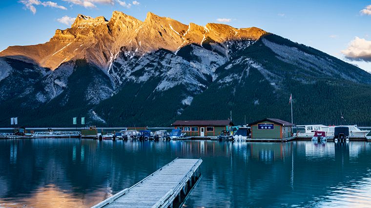
The Minnewanka Drive is a scenic loop along the lake. The road begins at the end of Banff Avenue, after it crosses the Trans-Canada Highway. This beautiful landscape is home to many wild animals. You’re almost certain to encounter bighorn sheep and deer, and if you’re lucky, you might also see foxes and perhaps even a grizzly bear. If you do see a grizzly bear, it’s important to stay in your rental car!
Please note: From mid-November through mid-April, the western section of the Minnewanka Loop is closed because it serves as a key wildlife corridor. Lake Minnewanka and the other small lakes in the area are still accessible by turning right after the Cascade Ponds. However, during these months, you’ll have to take the same route back.
Bow Valley Parkway
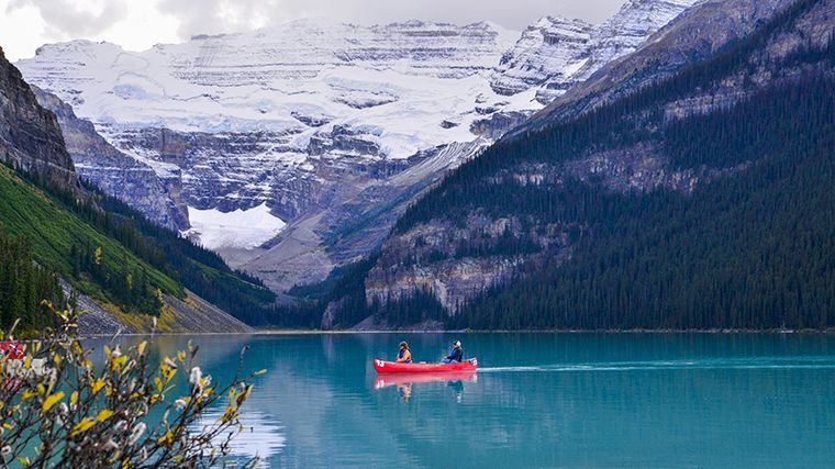
From Banff, it takes about 45 minutes to drive to Lake Louise on Highway 1 in a rental car. A more scenic route is the Bow Valley Parkway, which runs parallel to it. Along the way, you can stop at various points of interest, which means the drive between Banff and Lake Louise takes a few hours. There are several overlooks with interpretive signs along the route. Perhaps the most famous stop along this road is the hiking trail through Johnston Canyon. The trail is well-maintained and offers stunning views of the canyon walls, flowing water, and rugged waterfalls. It’s also a great hike in the winter. It’s much less crowded then, and the white snowy landscape and frozen waterfalls make for an enchanting experience.
Lake Louise / Moraine Lake
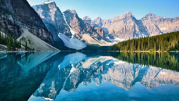
Lake Louise is named after the spectacular glacial lake of the same name located west of the town. The best time to see the lake is early in the morning, before hordes of other tourists arrive, or in the early evening, once they’ve already left. You can also choose to leave your rental car behind and reserve a seat on the shuttle bus, which stops not only at Lake Louise but also at the even more beautiful Moraine Lake. It’s no longer possible to drive to Moraine Lake on your own, so this is actually the best option.
Icefields Parkway
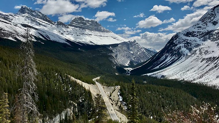
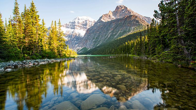
Lake Louise is the starting point of the iconic road trip along the unparalleled Icefields Parkway, between Banff and Jasper National Parks. You can cover the 230 kilometers in three hours, but if you really want to enjoy the incredible scenery, be sure to make stops along the way and go for hikes. That way, you’ll easily spend three days on this route that’s on everyone’s bucket list. To be honest, during the summer months, you certainly won’t be the only one driving this fantastic route past towering, jagged mountains, ice-blue lakes, and glistening glaciers. So it’s much better to drive from Lake Louise to Jasper in the spring or fall—or even in the winter, although some attractions along the Icefields Parkway will be inaccessible then.
Just outside Lake Louise, the road runs past Hector Lake, at the foot of the Waputik Range, and further on you’ll have a view of the Crowfoot Glacier, which, incidentally, is retreating further and further, just like many other glaciers in the Rocky Mountains.
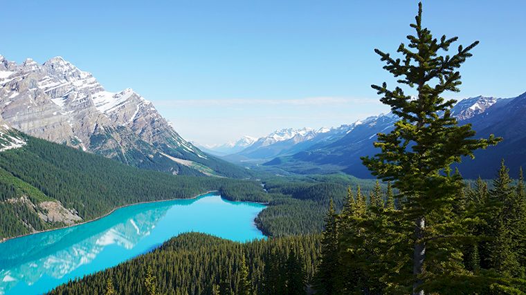
Peyto Lake is a must-see, because the sight of its turquoise-blue waters, surrounded by deep-green conifers, is one you won’t soon forget. That is, unless you’re there in the winter, when the lake is frozen. But even then, the view is unforgettable. Sometimes in winter you can’t drive all the way to the Bow Summit parking lot, but you can walk to the overlook.
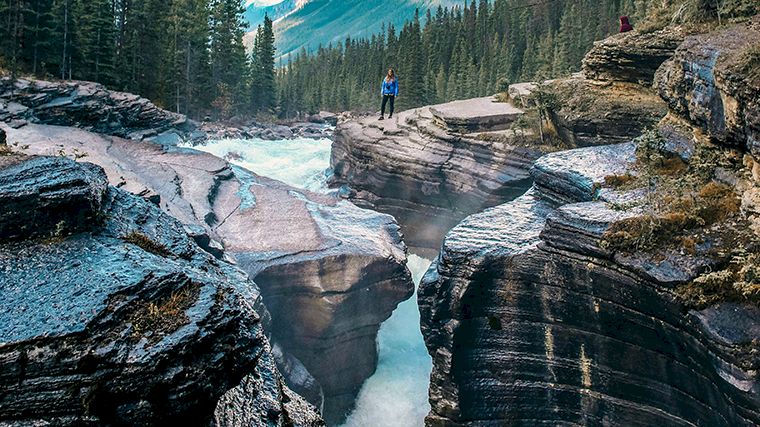
From there, the road descends to Waterfowl Lake, where you’ll have a breathtaking view of the lake with the impressive White Pyramid mountain (3,219 m) in the background. Here you’ll drive through the Mistaya River valley, and from the road there’s a trail leading to the narrow gorge carved out by the river. From the Mistaya Canyon parking lot, it’s just a 500-meter walk to a small viewing bridge where roaring, foaming water rushes through the rocks below you.
Five kilometers further on, there’s a bridge over the Howse River, offering a fantastic view of the Mount Wilson mountain range. This is the Saskatchewan River Crossing, where three rivers converge: the Howse, the Mistaya, and the North Saskatchewan River. The view from the road is only so-so, so we recommend pulling over in your rental car and following one of the hiking trails down to the rivers. This is also the only gas station along the Icefields Parkway, but you’ll pay top dollar there!
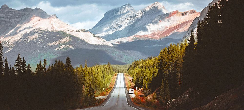
The view from the Cirrus Mountain Viewpoint (see the first photo above) perfectly captures what this route is all about: a fantastic road cutting right through a breathtaking mountain landscape. It’s a good thing there are so many lookouts, so the driver can fully enjoy the scenery too. It’s even more fun to switch drivers at one of these rest stops. Did you know it’s very easy to reserve a rental car with an additional driver?
Shortly after this beautiful viewpoint, a steep trail leads from the parking lot next to the road to Parker’s Ridge. If you only have time for one hike, make it this one. You’ll climb 275 meters to the top of a ridge with unforgettable views of the Saskatchewan Glacier.
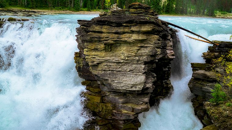
You can see even more glaciers at the Columbia Icefield Discovery Center. If you park across from the information center, you can admire the glaciers from a distance, but if you want to set foot on the Athabasca Glacier, you’ll need to book a (rather pricey) spot on one of the special snow buses. That glacier is the source of Sunwapta Falls, which plunges 18 meters into a gorge. Even higher and wider are the Athabasca Falls, 24 kilometers further on.
From this spot, during the summer months, you can take an alternate route to Jasper via Highway 93A, which locals call “the old highway.” This final stretch of the route runs through an area that was severely affected by massive wildfires in 2024. In Jasper, the SkyTram takes you to the summit of Whistler’s Mountain at an elevation of nearly 2,500 meters, offering unparalleled views of the surrounding peaks and valleys.
Kananaskis Country
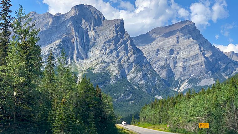
Did you know that there are many more nature areas near Calgary that are often overlooked? The area immediately west of the city is called Kananaskis Country , also known as K-Country for short. If you drive west on Highway 1, you’ll see the exit clearly marked. Follow Highway 40, and after about six kilometers, you’ll arrive at the visitor center, where you can purchase an access pass. Be sure to have your rental car’s license plate number handy. An easier option is to purchase the Kanaskis Conservation Pass online in advance. The road runs right alongside a wild, rushing river here, where you can go kayaking and rafting. There’s a hiking trail leading to a spot called Widowmaker. We’ll leave it to your imagination to figure out how it got its name.
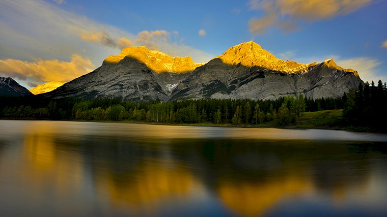
The region is divided into several provincial nature parks, and your visitor pass grants you access to all of them. The scenery along Highway 40 alone is breathtaking, but of course you’ll need to venture off that main road to truly enjoy it. This is classic Rocky Mountains terrain, with snow-capped, steep mountain peaks, cold rivers flowing through narrow valleys, and crystal-clear blue lakes. The highest point is Mount Galatea (3,185 m), and there are several other peaks over 3,000 meters. The fantastic Spray Lakes Road (Highway 742) runs along an elongated reservoir back to Canmore. Just before you reach that town, you can follow a trail to Ha Ling Peak, which offers a spectacular view of the Bow River valley.
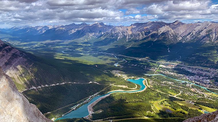
There are countless hikes to enjoy in Kananaskis. Be sure to wear layers, because even on a sunny day, it can be very windy at the top of a mountain and much colder than in the valley. In addition to hiking, Kanaskis Country offers mountain biking, horseback riding, canoeing, kayaking, rafting, cycling, and, of course, wildlife spotting in the summer. There are also countless spots for picnicking. In the winter, you can go cross-country skiing, downhill skiing, snowboarding, ice fishing, and take trips on snowshoes or snowmobiles.
Kootenay National Park
Icefields Parkway is officially known as Highway 93 North. There is also a Highway 93 South, which runs from Castle Junction to Radium Hot Springs and Kootenay National Park in the neighboring province of British Columbia. This road also winds through spectacular scenery. If you’ve rented a car in Calgary, you’ll first drive over Vermilion Pass, which marks the border between the two provinces and is also the point of the so-called Continental Divide. On one side, the river flows toward the Pacific Ocean; on the other, it flows (eventually) toward the Atlantic Ocean. From the parking lot, there’s a short hiking trail through the forest, with interpretive signs explaining the fire that raged there in 1968 and how nature recovered afterward.
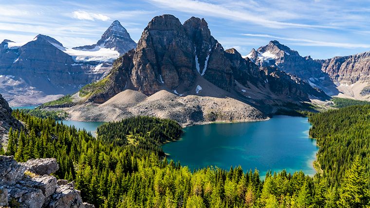
A little further on, there’s a parking lot at the start of the hiking trail to Stanley Glacier. The trail climbs gradually, and once you’re above the tree line, you’ll have amazing views of the mountain ranges and, of course, the glacier. Less than four kilometers further on, there’s another good reason to pull over your rental car and stretch your legs in Marble Canyon. Here, a fairly easy trail—though with some elevation changes—runs along the narrow gorge of the fast-flowing Kootenay River, which you’ll cross several times via small bridges. You’ll also see the river from the car, as the road runs right alongside it.
You’ll reach Numa Falls after a three-minute walk from the parking lot. From the small bridge over the waterfall, you can follow various longer hiking trails. In a few spots throughout the park, you’ll find so-called “Red Chairs,” which make for the perfect Instagram photo. This is also the case at the Simpson River Trail, where the Simpson River flows into the Kootenay. As you continue on your way, you’ll find it hard not to be distracted by the fantastic view of the valley and the mountain ranges across the way. Don’t worry—there’s a viewpoint: Kootenay Valley Viewpoint.
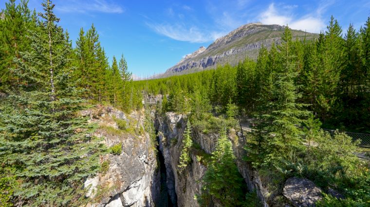
In Radium Hot Springs, you can not only take a dip in the hot springs, but you can also enjoy a wonderful hike through Sinclair Canyon. It’s not a long canyon, but it’s impressive, with high cliffs, lush greenery, and the babbling waters of the river. It’s best to park your rental car in a lot at the end of the road next to the Canford Sawmill.
Bar U Ranch
About 100 kilometers south of Calgary by car is a really fun open-air museum, Bar U Ranch, which is a must-see if you’re traveling with children. This ranch showcases life as it was from the late 19th century through the 1950s. Various buildings and farm equipment, as well as staff in period costumes, allow you to experience and understand life on the historic ranch. You can only visit the ranch between mid-May and mid-September.
Frank Slide / Bellevue Mine
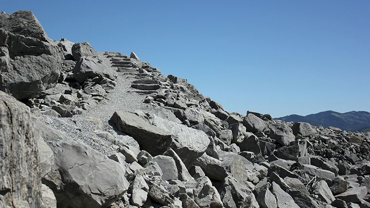
From the ranch, Highway 22 continues south through rolling hills. At the end of that road, take the turnoff to the Frank Slide Interpretation Center (Highway 3). On your way there, you’ll be amazed by the enormous boulders lying to the left and right of the road. They are silent witnesses to a massive landslide that wiped out half of the town of Frank in 1903. You can still clearly see where the mountainside collapsed, especially from the observation deck at the visitor center. Incidentally, the center isn’t just about this disaster; it also highlights the area’s early settlement and archaeological sites.
On the way back, you can spend an hour underground in the Bellevue Coal Mine. Equipped with a miner’s helmet and lamp, this is a wonderfully fun and educational experience, even for children. You do need to book the tour in advance.
Waterton Lakes National Park
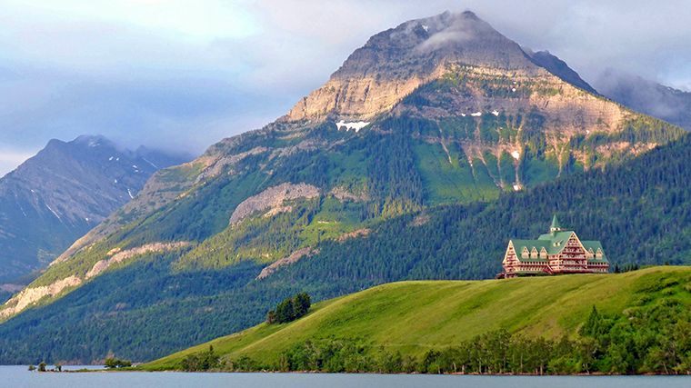
From Bellevue, it’s another 100 kilometers to Waterton, located in the heart of a Canadian national park that you really shouldn’t miss: Waterton Lakes. Before you drive into town in your rental car, there’s a parking lot near the trail to Bear’s Hump. It’s a challenging climb of over one kilometer to the top, but once you see the view, you’ll forget all that effort. From there, you’ll look out over two of the three Waterton Lakes (Middle and Upper), the surrounding mountains, and the iconic Prince of Wales Hotel.
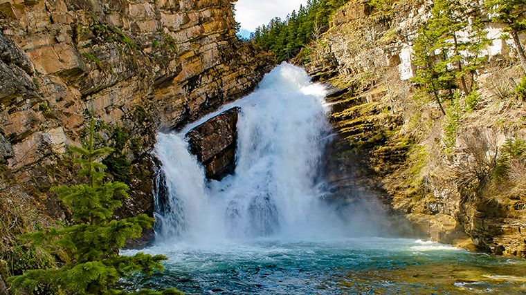
In addition to glacial lakes and forests, the park is home to many waterfalls. You’ll find one right on the western edge of Waterton: Cameron Falls. That’s also the starting or ending point of the Carthew-Alderson Trail. It’s a long, beautiful, but also quite strenuous hiking trail that winds through all the different landscapes of Waterton and passes four alpine lakes surrounded by high peaks. Many people use the shuttle service between Waterton Park and Cameron Lake to start their hike from there, but you can also drive there in your rental car via the Akamina Parkway. The shorter hike to Bertha Lake (and past Bertha Falls) is also stunning.
Waterton Lakes borders Glacier National Park in the United States, but Canada also has a park with that name—it’s just located somewhere else entirely.
Glacier National Park (Canada)
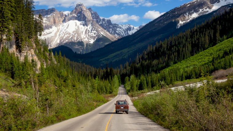
It’s quite a drive from Calgary to Glacier National Park in Canada—over three hundred kilometers—but if you’re already in Lake Louise, you’re not even halfway there. You’ll be driving along the Trans-Canada Highway, and along that highway there are plenty of spots where you’ll want to pull over or take a detour to see some beautiful natural wonders. It’s funny that just past Golden, you’ll enter a different time zone. A sign along the road tells you to set your watch back an hour. Half a kilometer further on, you’ll see a sign marking the border of Glacier National Park.
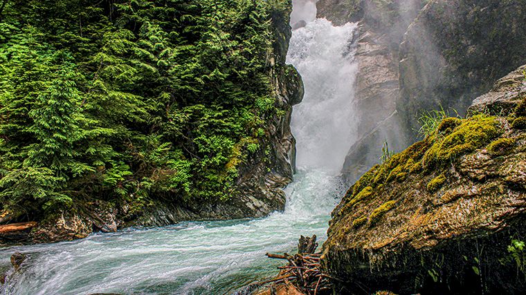
Rogers Pass is historically significant because the first railroad line through the Selkirk Mountains was built here. However, it quickly became unusable due to frequent avalanches, so a tunnel was later bored. At the visitor center, you can get information about the many hiking trails. The Balu Pass Trail starts right behind the center, but there are many more beautiful hikes to enjoy in this national park. Be prepared for challenging terrain and steep slopes.
Drumheller
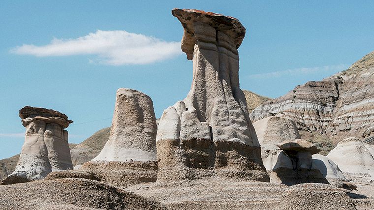
For something completely different from the Rocky Mountains, drive to the so-called Badlands near Drumheller. If you’ve rented a car in Calgary, it’s a little over an hour and a half drive. On both sides of the road, you’ll see striped rock layers in various shades of red, brown, and gray. Fossils of various dinosaur species have been found in this area and are on display at the Royal Tyrrell Museum. The surrounding landscape sets your imagination racing: millions of years ago, these enormous creatures roamed these very lands. Among other things, you’ll see so-called hoodoos in this unique landscape—sandstone pillars formed by erosion.
Driving a rental car in western Canada
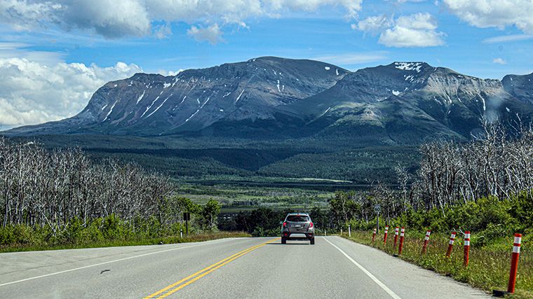
There are fantastic roads winding through the incredibly impressive natural scenery in western Canada. However, many of these roads have speed limits, and they’re there for a reason. It’s quite common for a deer or moose to cross the road, and you’ll want to be able to brake in time. Not only to protect those wild animals, but also to prevent damage to your rental car. Drive slowly if you see animals along the road, but don’t slam on the brakes—drivers behind you won’t appreciate that.
A very useful website to check before hitting the road in Alberta with your rental car is 511. There you’ll find information about highway conditions, roadwork, major incidents, and extreme weather. There are also links to webcams, and you can enter a route to see if any warnings are in effect along that stretch. The province of British Columbia offers this service through the DriveBC website.
Renting a Car with Winter Tires in Calgary
Speaking of that neighboring province: From October 1 through April 30, winter tires are required on most roads in British Columbia, but so-called all-season tires (with the M+S symbol) are sufficient. In Alberta, there is no requirement for special tires in the winter, but you will need them if you’re driving to Kootenay or Glacier National Park during the winter months, as those parks are located in British Columbia. Cars rented in Calgary are never equipped with winter tires as standard (though they may come with M+S tires). You can reserve winter tires separately, but you’ll pay the cost directly to the rental company when you pick up the car.
One-way car rental in Calgary
The Classic Loop is a round-trip route between Banff National Park and Vancouver on Canada’s west coast. The total distance is more than 2,500 kilometers, and not everyone has the time for such a long road trip. But why not do half of it? Choose the northern or southern route and drop off your rental car at, for example, Vancouver Airport. This is called one-way car rental and is very easy to arrange. Enter your pickup and drop-off locations on our search form, and we’ll show you only rental cars for which that combination is available. Did you know that the route between Calgary and Vancouver is so popular that many car rental companies don’t even charge a one-way fee for it? Start looking for a rental car in Calgary today!

Where would you like to rent a car?
- 24000+ pick-up locations
- Free cancellation
- Independent comparator

Useful tips for a well-prepared trip
Which insurance should I choose, and what's the deal with the deposit? Read our articles with useful information and tips to ensure you choose the right rental car for you.


